Deliver Your Subsurface Projects in Interactive, True 3D — Not Static Slides
Stop sending screenshots. Present your geodata and models in interactive 3D spaces that can be explored, annotated, and shared instantly.

LiquidEarth is compatible with Windows, macOS, iPadOS, iOS, Android, and the Meta Quest platform.

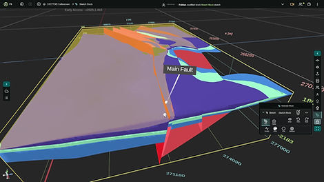
Visualize Subsurface Data in True 3D
Explore geological models, drillholes, geophysical volumes, and other key subsurface datasets in an intuitive, fully interactive 3D environment.
Annotate
& Interpret
Track and mark insights with text, sketches, viewpoints, and more — making your observations and interpretations easy to revisit and share.
Create Impactful
3D Presentations
Lead clients and stakeholders through structured project walkthroughs — or let them explore freely in 3D, guided by contextual annotations.
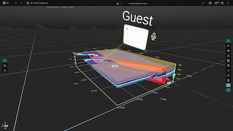
Share Projects Instantly, With Anyone
Share a simple link and let others join your 3D project as guest viewers — no signup needed, just a quick install.
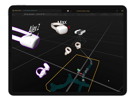
Collaborate in
Real Time, in 3D
Join colleagues or stakeholders in the same 3D space, interact live with data, and communicate using built-in voice chat.
Access Anywhere, Across Devices
From office PCs to field tablets and XR headsets — LiquidEarth runs across modern hardware without heavy setup.
How It Works:
From Data to Engaging 3D Spaces
Whether you're a geoscientist, engineer, consultant, or educator: Here's how LiquidEarth helps turn your raw data into impactful, shareable 3D spaces.
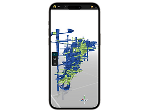
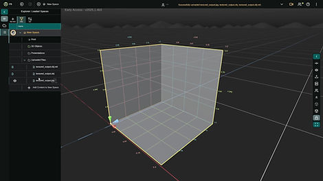
1. Import Your Data
Bring your geoscience and subsurface data into interactive 3D spaces in LiquidEarth.
Our in-app workflow supports importing meshes, boreholes, raster images, and voxel volumes — with a growing range of formats being added based on user needs.
Need assistance? We also offer support and services to help you optimize and integrate your data for the best experience across platforms.
2. Highlight What Matters
Mark key insights and add context, whether for your own interpretation or to communicate your work clearly.
LiquidEarth offers a range of visualization and inspection tools to help you understand your data in 3D. Use annotations to add spatial notes, sketch features, link resources, or save and revisit specific viewpoints.
Looking for a more guided experience? We can help you create custom, step-by-step walkthroughs tailored to your audience.
3. Share, Present, and Collaborate Live
Invite others to your project to present results or discuss interpretations in real time and true 3D.
Share projects directly in the app to add team members as permanent collaborators, or send sharing links to let external clients and stakeholders join instantly as guest viewers — no signup required, just a quick install.
Meet in LiquidEarth to exchange insights, inspect data together, and engage your audience directly. Instead of sending static slides, guide them through an immersive 3D environment.
Explore Examples in LiquidEarth
Get to know LiquidEarth through real-world 3D geoscience datasets and models.
Try it for free — no signup required. Click a link, install the app, and start exploring as a guest viewer.
Note: These spaces are public and free to view. When you join, you may encounter other users viewing the same project.
You can disable live collaboration via the top bar in the app.


Start Using LiquidEarth Today
Start exploring the app for free — or unlock full functionality with a commercial license.
LiquidEarth is currently in Early Access. It’s ready for application in a variety of real-world use cases and is regularly updated with new features and improvements.
Extended Trials: We’re currently offering free extended trial licenses for selected projects and teams. To request a trial license, reach out via our contact form or email us directly.
Want to use LiquidEarth for education and research? Contact us to discuss academic licensing options and opportunities for scientific partnerships.

LiquidEarth Features (v2025.1)
FAQ

Join the LiquidEarth Community
Stay up-to-date with LiquidEarth! Sign up for our newsletter to receive the latest updates, product releases, news, and special offers straight to your inbox.